 |
|
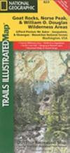
Goat Rocks & Norse Peak, Gifford-Pinchot & Okanogan-Wenatchee National Forests. Trails Illustrated Map #823 (National Geographic Maps: Trails Illustrated)
National Geographic Maps
Map. Natl Geographic Society Maps 2010-09-01.
ISBN 9781566955065
|
|
|
|
Hitta bokens lägsta pris
|
Förlagets beskrivning
One of five new Trails Illustrated maps for the Washington Cascades region offers the most detailed and up-to-date map for the forest, carefully researched and developed in co-operation with local land managers and agencies. Each map contains easy to read trails, numbered forest service roads, campsites, access points, scenic points-of-interests, and important facilities.
The Goat Rocks Wilderness is a unique area characterized by high alpine terrain and fantastic scenic views. This 105, 633 acres wilderness is centered around an ancient volcano which dominated the area some two million years ago. This area features mountainous terrain with elevations between 3, 000 and 8, 184 feet. Much of this area lies above timberline and provides outstanding scenery. Elk, mountain goats, marmots, deer, and a variety of birds reside within this wilderness.
The Norse Peak Wilderness is located in the central Washington State Cascade Range north of Chinook Pass and east of Mt. Rainier National Park. This 50, 923 acre wilderness is names for a prominent peak which overlooks Crystal Mountain Ski Area. The Pacific Crest National Scenic Trail runs along the Cascade ridge in the Norse Peak Wilerness. The historic Naches Pass Trail runs east and west just outside the north Norse Peak Wilderness boundary.
The William O. Douglas Wilderness includes 166, 000 acres located between the White Pass and Chinook Pass highways and is jointly administered by the Gifford Pinchot National Forest and the Wenatchee National Forest. The Pacific Crest National Scenic Trail, which extends from Mexico to Canada, runs along the 27-mile crest of this wilderness.
Like all Trails Illustrated maps our new Washington Cascades titles are both highly durable and environmentally friendly. Each map is printed in the United States, at a certified green printer, using low V.O.C. inks on waterproof, tear-resistant material. Proceeds from the sale of Trails Illustrated Maps go to support the National Geographic Society s nonprofit mission to increase global understanding and promote conservation of our planet through exploration, research, and education
Fler böcker av National Geographic Maps
Liknande böcker
Recensioner
Den här boken har tyvärr inte några recensioner ännu. Om du redan läst boken, skriv en recension!
Recensera boken
Skriv en recension och dela dina åsikter med andra. Försök att fokusera på bokens innehåll. Läs våra instruktioner för mer information.
Goat Rocks & Norse Peak, Gifford-Pinchot & Okanogan-Wenatchee National Forests. Trails Illustrated Map #823
Bokrecensioner » Goat Rocks & Norse Peak, Gifford-Pinchot & Okanogan-Wenatchee National Forests. Trails Illustrated Map #823 (National Geographic Maps: Trails Illustrated)
|
|
 |
|
|
|
|

![Camino de Santiago Map [Map Pack Bundle] Map](https://coverdb.com/reviewSE/w90/28c/1566959233.jpg)
![Camino de Santiago East Map [Map Pack Bundle] Map](https://coverdb.com/reviewSE/w90/e23/1566959276.jpg)
![Camino de Santiago West Map [Map Pack Bunde] Map](https://coverdb.com/reviewSE/w90/5bc/1566959284.jpg)
![Moab Day Hikes & Moab Greater Region [Map Pack Bundle]](https://coverdb.com/reviewSE/w90/519/1566959624.jpg)

![Glacier Peak Wilderness [Mt. Baker-Snoqualmie and Okanogan-Wenatchee National Forests] (National Geographic Trails Illustrated Map)](https://coverdb.com/reviewSE/w90/b33/1566955092.jpg)