Förlagets beskrivning
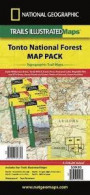
One of the most-visited urban forests in the U.S., with approximately 5.8 million visitors annually, the Tonto National Forest spans almost 3 million acres of diverse terrain just outside of Phoenix, AZ. Tonto encompasses a wide variety of vegetation ranging from cactus-studded desert to pine-forested mountains, and numerous recreational opportunities throughout the year.
Our four new Trails Illustrated maps are the most detailed and up-to-date for the forest, carefully researched and developed in co-operation with local land managers and agencies. Each map contains easy to read trails, numbered forest service roads, campsites, parking, access points, scenic points-of-interest, and important facilities.
Features on the Superstition & Four Peaks Wilderness Map include:
- Arizona and Great Western Trails
- Locations of Public Facilities and Fee Areas
- Motorized and Non-Motorized Trails
- Equestrian & Multiple Use Trails
- Agency Contact and Recreation Information
Like all Trails Illustrated maps our new Tonto National Forest titles are both highly durable and environmentally friendly. Each map is printed in the United States, at a certified green printer, using low V.O.C. inks on waterproof, tear-resistant material.
Proceeds from the sale of Tonto National Forest Trails Illustrated Maps go to support the National Geographic Society s non-profit mission to increase global understanding and promote conservation of our planet through exploration, research, and education.
Scale: 1:70, 000 (1 = 1.10 Miles)
Fler böcker av National Geographic Maps
Liknande böcker
Recensioner
Den här boken har tyvärr inte några recensioner ännu. Om du redan läst boken, skriv en recension!
Recensera boken
Skriv en recension och dela dina åsikter med andra. Försök att fokusera på bokens innehåll. Läs våra instruktioner för mer information.
851- Superstition & Four Peaks Wilderness Areas, AZ
Bokrecensioner » 851- Superstition & Four Peaks Wilderness Areas, AZ (National Geographic Maps: Trails Illustrated)
|
|
 |
|
|
|
|

![Camino de Santiago Map [Map Pack Bundle] Map](https://coverdb.com/reviewSE/w90/28c/1566959233.jpg)
![Camino de Santiago East Map [Map Pack Bundle] Map](https://coverdb.com/reviewSE/w90/e23/1566959276.jpg)
![Camino de Santiago West Map [Map Pack Bunde] Map](https://coverdb.com/reviewSE/w90/5bc/1566959284.jpg)
![Moab Day Hikes & Moab Greater Region [Map Pack Bundle]](https://coverdb.com/reviewSE/w90/519/1566959624.jpg)

![Glacier Peak Wilderness [Mt. Baker-Snoqualmie and Okanogan-Wenatchee National Forests] (National Geographic Trails Illustrated Map)](https://coverdb.com/reviewSE/w90/b33/1566955092.jpg)


