Förlagets beskrivning
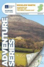
Among the rivers on this map are the Ow River, the Aughrim River, the Avoca River, the Derreen River and the Derry River. This map shows the historic site of Avondale House and Forest Park. The Wicklow Way continues down through the map. Among the many trails, loops and walks marked on this map are Avondale Trails, Avoca Red Kite Trails, Sean Linehan Walk, Ciaran Shannon Walk, Mangans Loop, Ballycumber Loop, Kyle Loop, Tinahely Railway Walk, and Tomnafinnogue. One Discovery map 1:50, 000 sheet 62, also covers this area. The Series is printed on Water Resistant Paper for greater durability
Fler böcker av Ordnance Survey Ireland
Liknande böckerTowns and Villages in County Wicklow, Including: Glendalough, Greystones, Bray, Arklow, Wicklow, Kilmacanogue, Enniskerry, Avoca, County Wicklow, Bles2016
Recensioner
Den här boken har tyvärr inte några recensioner ännu. Om du redan läst boken, skriv en recension!
Recensera boken
Skriv en recension och dela dina åsikter med andra. Försök att fokusera på bokens innehåll. Läs våra instruktioner för mer information.
Wicklow South
Bokrecensioner » Wicklow South
|
|
 |
|
|
|
|