Förlagets beskrivning
* Waterproof * Tear-Resistant * Topographic Map
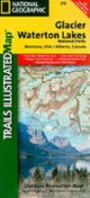
Seeking the best combination of detailed maps and value for your Glacier/Waterton Lakes National Parks trip, then get our bundle pack. It includes three of our Glacier/Waterton Lakes National Parks sectional Trails Illustrated maps, providing you coverage of the entire map region, while saving you over 15%. Like all Trails Illustrated maps, the Glacier/Waterton Lakes National Parks Bundle set is frequently revised and printed on waterproof, tear-resistant material to stand up to all conditions. This detailed topographic recreation map bundle contains carefully researched trails, campsites, forest service roads, and points-of-interests. Includes UTM grids for use with your GPS unit. Coverage includes: Glacier National Park, Waterton Lakes National Park, North Fork, Many Glacier, Two Medicine, Pacific Northwest Trail and more.
Sheet Size = 37.75 x 25.50Folded Size = 4.00 x 7.50Scale = 1:50, 000
Fler böcker av National Geographic Maps - Trails Illustrated
Liknande böcker
Recensioner
Den här boken har tyvärr inte några recensioner ännu. Om du redan läst boken, skriv en recension!
Recensera boken
Skriv en recension och dela dina åsikter med andra. Försök att fokusera på bokens innehåll. Läs våra instruktioner för mer information.
Glacier and Waterton Lakes National Parks [Map Pack Bundle]
Bokrecensioner » Glacier and Waterton Lakes National Parks [Map Pack Bundle] (National Geographic Trails Illustrated Map)
|
|
![Glacier and Waterton Lakes National Parks [Map Pack Bundle] (National Geographic Trails Illustrated Map)](/images/background.gif) |
|
|
|
|
![Glacier and Waterton Lakes National Parks [Map Pack Bundle] (National Geographic Trails Illustrated Map)](http://coverdb.com/reviewSE/w100/c40/9781597753999.jpg)


![Paria Canyon, Kanab [Vermillion Cliffs National Monument, Grand Staircase-Escalante National Monument] (National Geographic Trails Illustrated Map)](https://coverdb.com/reviewSE/w90/6cc/1566956854.jpg)
![Grand Staircase, Paunsaugunt Plateau [Grand Staircase-Escalante National Monument] (National Geographic Trails Illustrated Map)](https://coverdb.com/reviewSE/w90/5ec/1566956862.jpg)
![Glacier-Waterton Lakes Day Hikes & National Park Maps [Map Pack Bundle]](https://coverdb.com/reviewSE/w90/d63/1566958962.jpg)