Förlagets beskrivning
* Waterproof * Tear-Resistant * Topographic Map
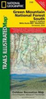
National Geographic's Green Mountain National Forest North Trails Illustrated topographic map is the most comprehensive available for outdoor enthusiasts of all types. Designed to be easy-to-read, yet highly detailed - this map includes a comprehensive road and trail network distinguishing between major, secondary and 4x4 roads, hiking, horse, biking, multi-use and non-motorized winter trails. All forest roads are labeled with their official road number and trails are clearly identified with their given name. Land management boundaries are color-coded showing National Forest, Ranger District, Wilderness Areas, Conservation Areas and more, plus the locations of private land within the Green Mountain National Forest. The renowned Appalachian Trail, Catamount Trail, and Long Trails are highlighted on the map.
An extensive collection of important and unique locations are pinpointed on the map including: visitor centers, campgrounds and backcountry shelters, picnic facilities, parking areas, RV dump sites, interpretive trails, boat launches, swimming holes, fishing areas, downhill and cross-country ski areas, waterfalls, viewpoints, museums, concessions, and Vermont's scenic covered bridges.
Every National Geographic Trails Illustrated map is an essential tool for safely navigating the backcountry with GPS or compass as they are clearly marked with both Latitude/Longitude and UTM coordinate grids, compass rose with magnetic declination, scale bar, and full legend.
Some of the places shown on the west side of the Green Mountain N.F. map are: Moosalamoo National Recreation Area, Joseph Battell Wilderness, Bristol Cliffs Wilderness, Breadloaf Wilderness, Rutland, Killington, Pico Ski Area, Sugarbush Ski Area, Lake Bomoseen, and more.
The east side of the map features: Hanover (NH), White River Junction, Woodstock, Quechee, Killington, White River, Connecticut River, Suicide Six Ski Area, Les Newell Wildlife Management Area, Granville Reservation, Roxbury State Forest, and more.
This Trails Illustrated map is printed in the U.S.A. on a durable synthetic paper, making it waterproof, tear-resistant, and capable for withstanding any condition mother nature can dish out. The map is two-sided, and can be folded to a packable size of (4.25" x 9.25"), unfolded size is (26" x 38")."
Green Mountains National Forest North adjoins the Green Mountains National Forest South map providing seamless coverage of Vermont's Green Mountain National Forest.
Net proceeds from the sale of this map go to support the non-profit mission of the National Geographic Society.
Specifications:
* Copyright 2010
* Scale 1:70, 000 (1" = 1.1 mile)
* Contour Interval 50 feet
* Folded Size (4.25" x 9.25")
* Unfolded Size (26" x 38")
* NG Product Number (TI00000747)Map Scale = 1:70, 000Sheet Size = 25.5" x 37.75"Folded Size = 4.25" x 9.25
Fler böcker av National Geographic Maps - Trails Illustrated
Liknande böcker
Recensioner
Den här boken har tyvärr inte några recensioner ännu. Om du redan läst boken, skriv en recension!
Recensera boken
Skriv en recension och dela dina åsikter med andra. Försök att fokusera på bokens innehåll. Läs våra instruktioner för mer information.
Green Mountain National Forest North [Moosalamoo National Recreation Area, Rutland]
Bokrecensioner » Green Mountain National Forest North [Moosalamoo National Recreation Area, Rutland] (National Geographic Trails Illustrated Map)
|
|
![Green Mountain National Forest North [Moosalamoo National Recreation Area, Rutland] (National Geographic Trails Illustrated Map)](/images/background.gif) |
|
|
|
|
![Green Mountain National Forest North [Moosalamoo National Recreation Area, Rutland] (National Geographic Trails Illustrated Map)](http://coverdb.com/reviewSE/w100/248/9781566955119.jpg)


![Paria Canyon, Kanab [Vermillion Cliffs National Monument, Grand Staircase-Escalante National Monument] (National Geographic Trails Illustrated Map)](https://coverdb.com/reviewSE/w90/6cc/1566956854.jpg)
![Grand Staircase, Paunsaugunt Plateau [Grand Staircase-Escalante National Monument] (National Geographic Trails Illustrated Map)](https://coverdb.com/reviewSE/w90/5ec/1566956862.jpg)